GIS & Remote Sensing Enthusiast | Geographer | Environmental Researcher
I am a GIS and Remote Sensing enthusiast with a strong focus on geospatial analysis, satellite image processing, and map creation. I work with tools such as ArcMap, ArcGIS Pro, QGIS, ENVI, Python, Google Earth Engine (GEE), Google Earth Pro, and IDRISI to develop accurate and insightful spatial solutions.
My work focuses on environmental monitoring, climate change analysis, land use planning, and data-driven decision-making. I am particularly interested in integrating geospatial technologies with climate modeling and real-time environmental monitoring systems.
Currently pursuing a Bachelor's degree in Geography and Environmental Studies at the University of Rajshahi, developing research skills and deepening understanding of environmental and spatial analysis. I am always eager to explore new geospatial challenges, contribute to impactful research, and collaborate on innovative projects.
Technical Skills
Academic Background
BSc — Geography and Environmental Studies
Courses: Remote Sensing · GIS & Spatial Analysis · Environmental Modeling · Climatology · Hydrology · Cartography · Urban and Regional Geography
Software: ArcGIS · QGIS · Python · Google Earth Engine (GEE) · SPSS · MS Office · Erdas Imagine
Language: Fluent in English and Bangla
Higher Secondary Certificate (HSC) — Science
Work
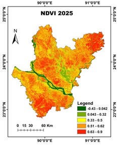
Vegetation Dynamics in the Dhaka Division(2015–2025).
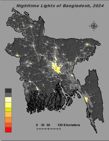
Urban expansion analysis using VIIRS and DMSP-OLS nighttime light imagery across Bangladesh.
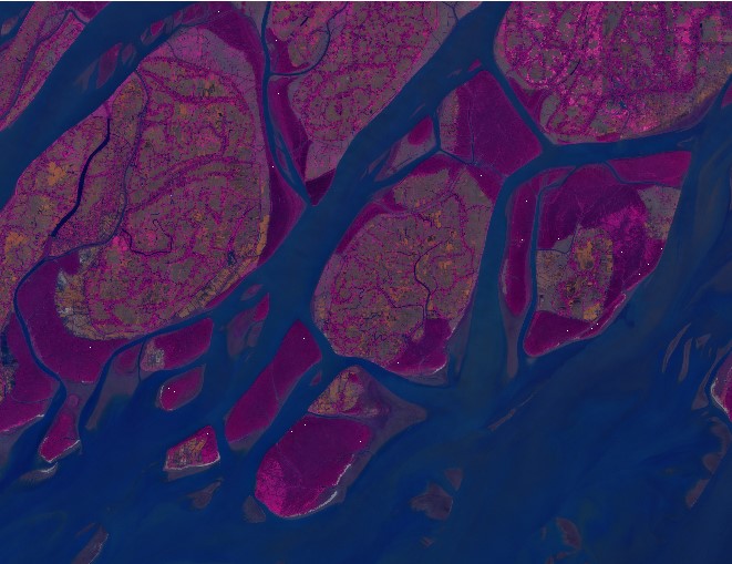
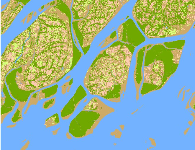
PCA Analysis using Sentinel-2 data
Watershed Analysis using DEM data
Multi-criteria spatial suitability analysis integrating environmental and geographic datasets.
Research
Modelling and forecasting vegetation dynamics using Remote Sensing (2000–2025).
Assessing flash flood vulnerability using GIS and multi-platform data.
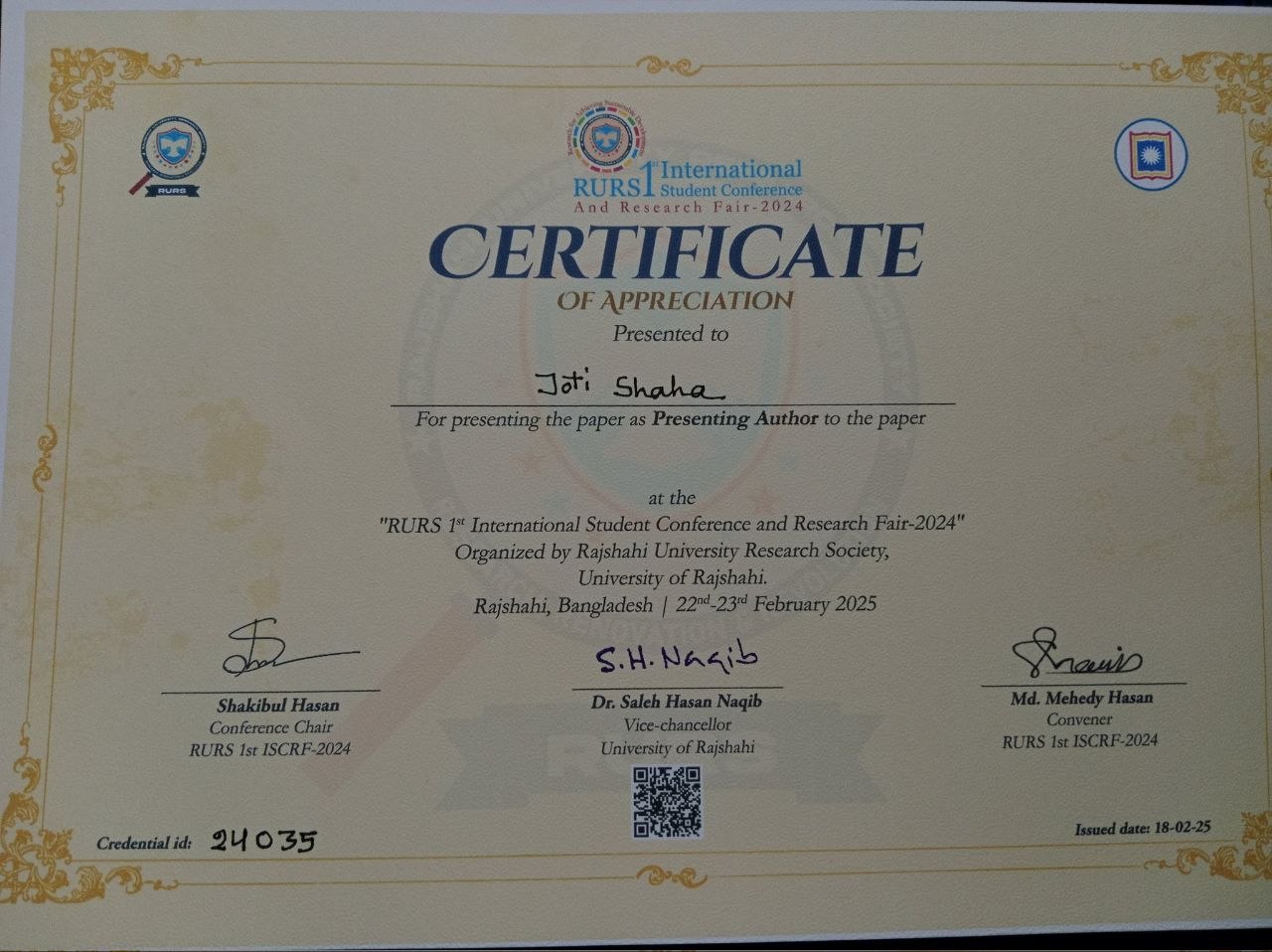
Identification of vegetation dynamics under a changing climatic scenario. Credential: 24035
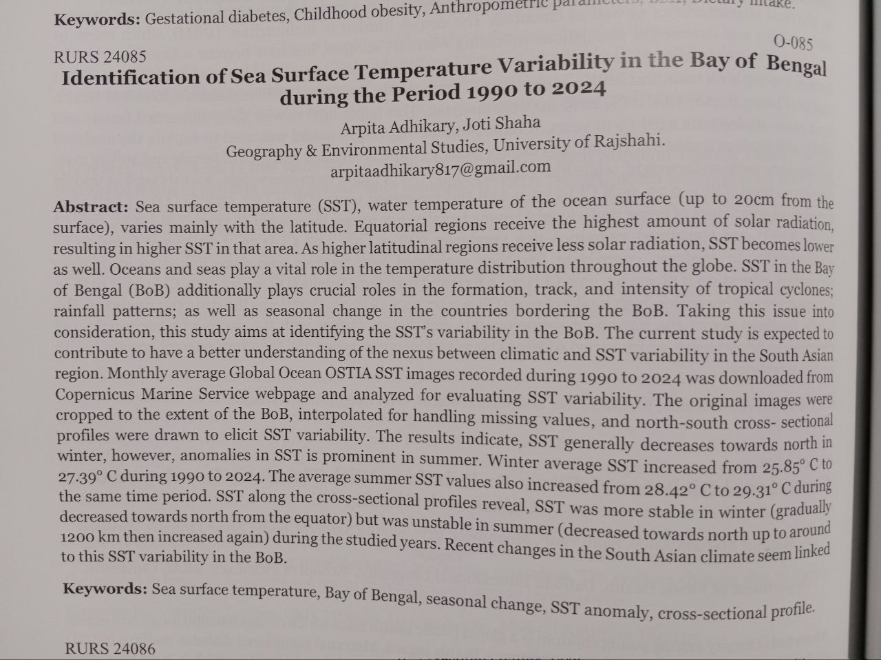
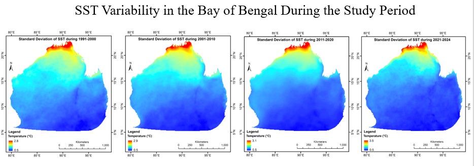
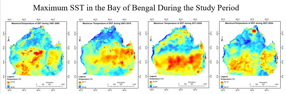
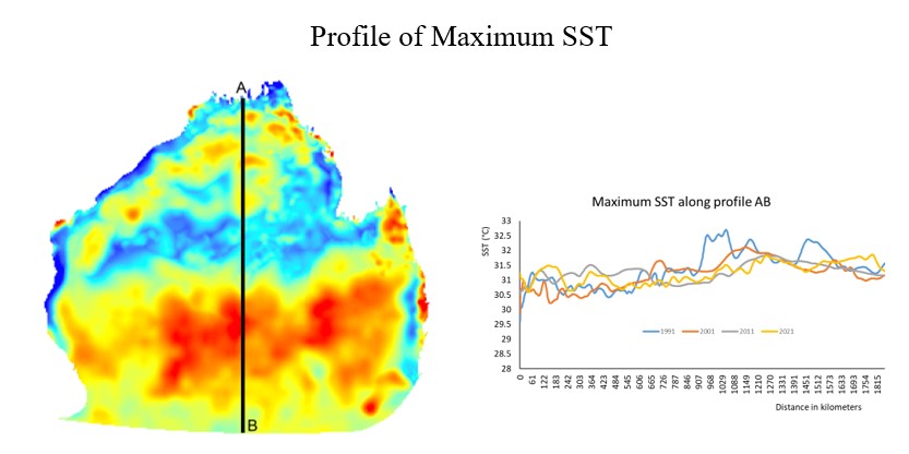
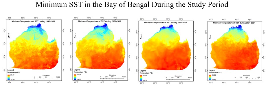
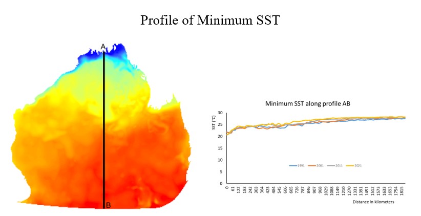
Identification of Sea Surface Temperature Variability in the Bay of Bengal during the Period 1990 to 2024. Credential: 24085
ACADEMIC
Case Study of Teknaf, Cox’s Bazar, Bangladesh
Comprehensive Report on Resource Potential.
An Analysis, Kuakata, Patuakhali, Bangladesh.
Competitions
Urban Green Space Dynamics in Dhaka City (2015–2025) using Landsat 8 NDVI on GEE.
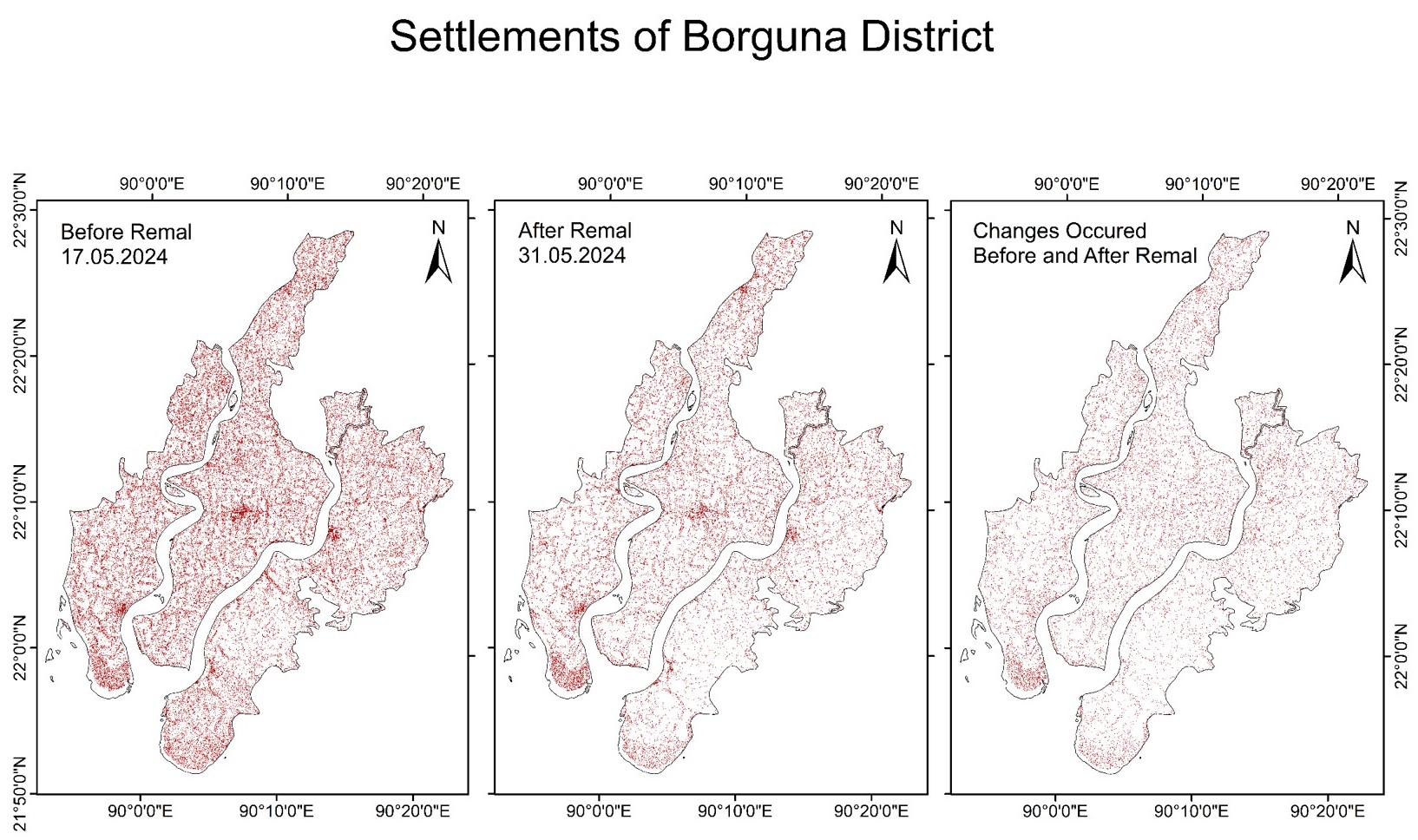
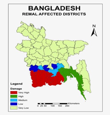
Automated infrastructural damage assessment — real-time damage mapping. Forewarn Bangladesh, 2024.
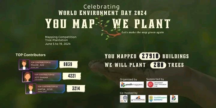
OpenStreetMap Bangladesh Mapathon, May 22, 2024.
Credentials
Esri, Google Earth Engine, Open Mapping Guru, and more professional credentials.
Specialized programs in GEE, QGIS, flood mapping, and OSM from 2024–2025.
Community
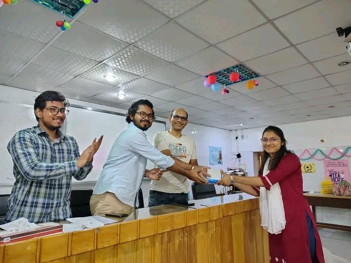
Member since May 2022. Data input, event organizer, OSM partnership builder.
Bangladesh chapter. Social welfare and geospatial community engagement.
Open Mapping Hub Asia Pacific. Recognized mapping leader since October 2024.
Space and Environment Research Center. Wetland Conservation Bangladesh project.
Let's Connect
Interested in collaboration, research projects, or geospatial consulting?
Feel free to reach out.
📍 Rajshahi, Bangladesh
Work
GIS and Remote Sensing Projects
Vegetation Dynamics in the Dhaka Division(2015–2025).
Urban expansion analysis using VIIRS and DMSP-OLS nighttime light imagery across Bangladesh.
PCA Analysis using Sentinel-2 Data.
Watershed Analysis using DEM Data.
ACADEMIC
Field research, reports, and academic project submissions
Case Studies of Moheskhali and Teknaf — field survey, GIS analysis, and environmental impact assessment.
Comprehensive mapping and report on resource potential across Rajshahi City Corporation area.
An analysis of tourism development potential at Kuakata, Patuakhali, Bangladesh.
Academic Projects
Driven by field-level insights and GIS technology, this research investigates the 2024–2025 development surge in Moheskhali and Teknaf. Through spatial change detection and direct community engagement, the project highlights the urgent need for zoning regulations that protect traditional salt pans and fishing grounds. The resulting maps serve as a visual evidence base for advocating sustainable, community-centric tourism policies that mitigate the environmental costs of rapid coastal urbanization.
An Analysis, Kuakata, Patuakhali, Bangladesh. (Oct 2022 – Feb 2023)
Research
All academic presentations, paper presentations, and poster sessions
Paper Presentations — International
Modelling and Forecasting of Vegetation Dynamics in the Chittagong Hill Tracts using Remote sensing (2000-2025).
Assessing flash flood vulnerability using GIS and multi-platform data.
Paper Presentations — Internatinal
Identification of vegetation dynamics under a changing climatic scenario. Credential: 24035
Sea Surface Temperature variability in the Bay of Bengal (1990–2024). Credential: 24085
Poster Presentations
World Environment Day poster presentation, University of Rajshahi, June 2024.
Hydrology and Fluvial Morphology poster presentation, August 2024.
Competitions
All national and international competition entries
Urban Green Space Dynamics in Dhaka City (2015–2025) using Landsat 8 NDVI on GEE.
Automated infrastructural damage assessment — real-time damage mapping. Forewarn Bangladesh Start Network, 2024.
OpenStreetMap Bangladesh Mapathon, May 22, 2024.
Credentials
All professional certifications and specialized training programs
Professional Certifications
Research Tech Hub
Esri — MOOC (6 weeks)
Esri
Esri — MOOC (6 weeks)
Esri — MOOC (4 weeks)
Esri
Asia Pacific and Humanitarian OpenStreetMap Team (HOT)
GIS & Remote Sensing Training Programs
ProSkill Academia
Spatial Thoughts
YouthMappers and Tom Tom
GEO University
YouthMappers at RU
Community
All community roles, volunteer work, and leadership positions
Member since May 2022. Data input, event organizer, OSM partnership builder.
Bangladesh chapter. Social welfare and geospatial community engagement.
Open Mapping Hub Asia Pacific. Recognized mapping leader since October 2024.
Space and Environment Research Center. Wetland Conservation Bangladesh project.
Modelling and Forecasting of Vegetation Dynamics in the Chittagong Hill Tracts (2000–2025)
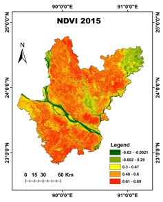
This project analyses the vegetation dynamics in the Dhaka Division of Bangladesh using NDVI derived from Landsat satellite imagery on Google Earth Engine.
Time-series NDVI data from 2015 to 2025 was processed to assess seasonal and long-term vegetation change. Statistical trend analysis was applied to identify areas of vegetation gain, loss, and stability in response to climate variability and land-use pressures.
Urban Expansion Analysis using Nighttime Light Imagery
Urban expansion and socioeconomic growth patterns across Bangladesh quantified using VIIRS Day/Night Band and DMSP-OLS nighttime light imagery.
Multi-temporal analysis of nighttime light radiance values was used to detect urban sprawl, identify areas of development, and correlate light intensity with demographic and economic growth indicators.
PCA Analysis using Sentinel-2 Data.
Applied PCA algorithms to multispectral satellite imagery to eliminate data redundancy and enhance the classification of land-use patterns, improving computational efficiency by focusing on high-variance principal components
A methodology using ArcGIS and TerrSet involves preprocessing multiband rasters in ArcGIS, performing the Principal Components Analysis within TerrSet’s specialized statistical engine to extract significant variance, and returning to ArcGIS for final thematic mapping and spatial decision-making.
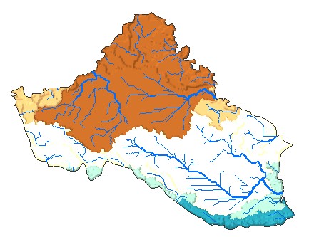
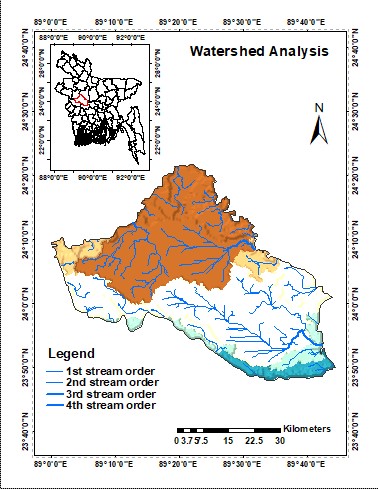
Watershed Analysis using DEM Data.
Applied watershed analysis techniques on high-resolution DEM data to delineate drainage basins and hydrological flow patterns. This approach enhances the understanding of surface water dynamics, runoff distribution, and catchment characteristics for improved spatial decision-making.
The workflow involves preprocessing the DEM in ArcGIS/ArcGIS Pro, including sink filling to remove depressions, followed by flow direction and flow accumulation modeling. Watershed boundaries are then delineated using pour points, enabling accurate extraction of drainage networks and basin extents for further hydrological analysis and mapping.
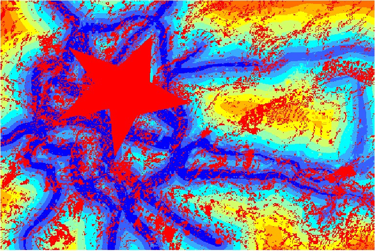
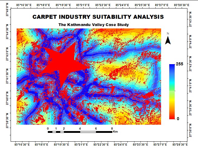
Multi-Criteria Spatial Suitability Mapping
Spatial suitability analysis integrating multiple environmental, social, and geographic datasets to identify optimal zones for a specific land-use purpose.
GIS-based weighted overlay and multi-criteria evaluation (MCE) techniques applied, combining slope, land cover, proximity to infrastructure, and environmental sensitivity into a composite suitability map.
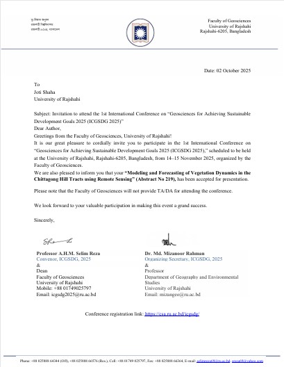
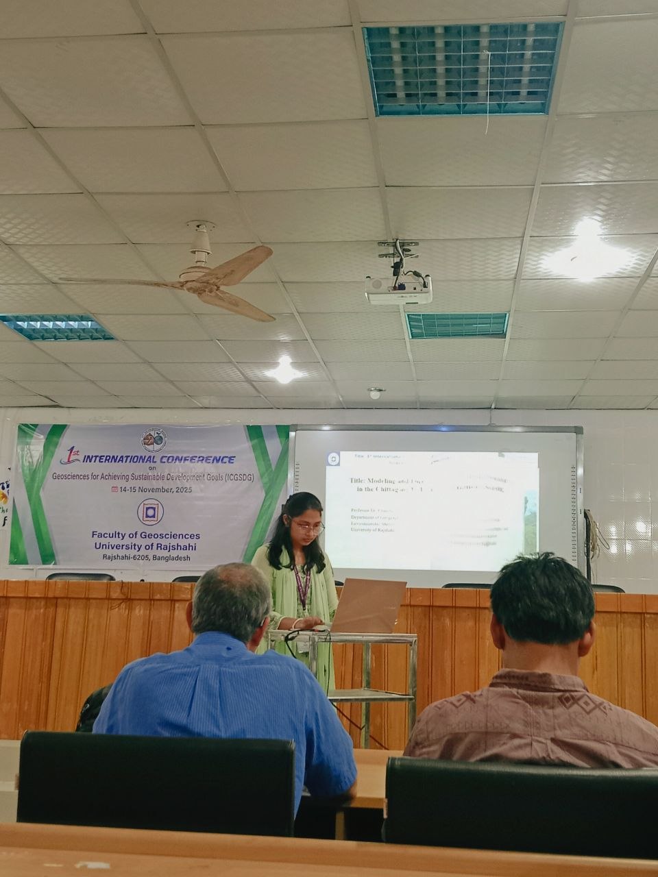
ICGSDG · 14–15 November 2025 · Paper Presenter
Modelling and Forecasting of Vegetation Dynamics in the Chittagong Hill Tracts using Remote Sensing (2000–2025)
Joti Shaha, Chandan Roy & UMong Ching Marma
International Conference on Geosciences for Achieving Sustainable Development Goals (ICGSDG), 14–15 November 2025
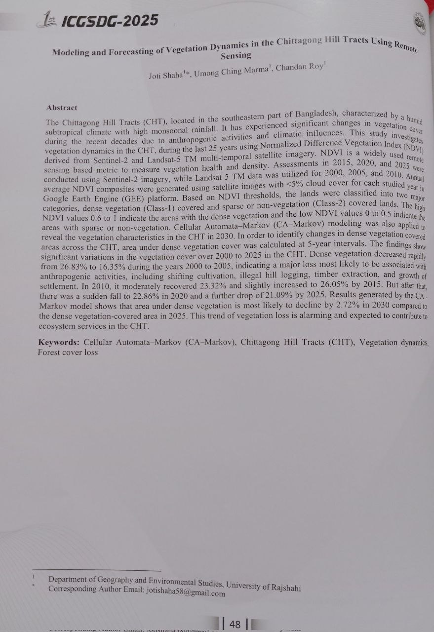
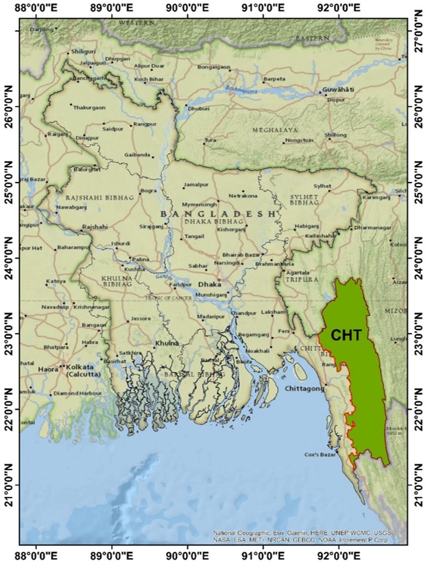
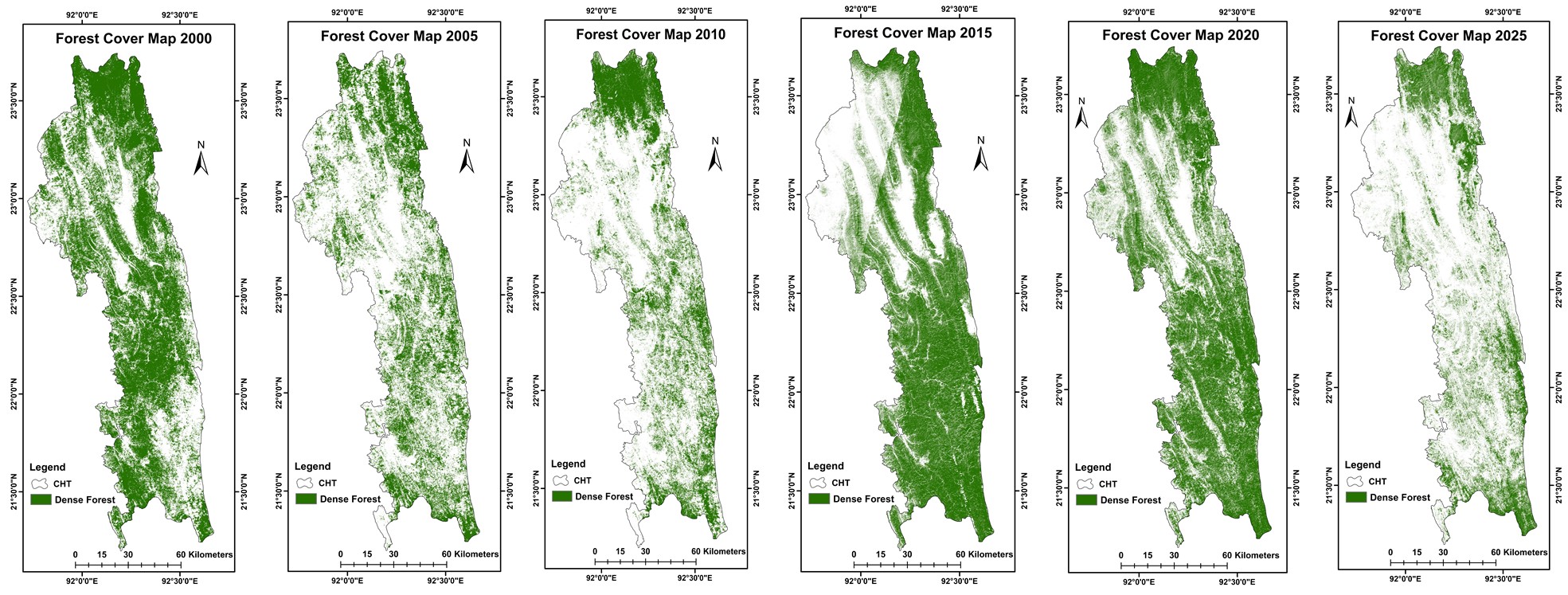
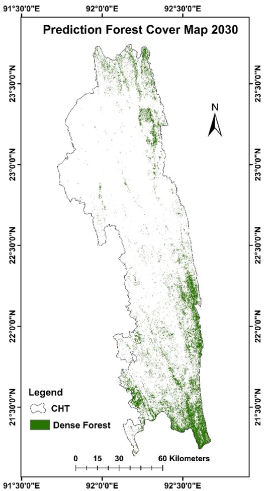
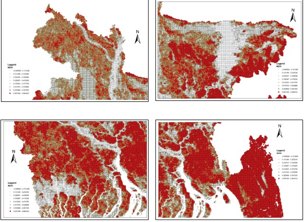
The Chittagong Hill Tracts (CHT), located in the southeastern part of Bangladesh, characterized by a humid subtropical climate with high monsoonal rainfall. It has experienced significant changes in vegetation cover during the recent decades due to anthropogenic activities and climatic influences. This study investigates vegetation dynamics in the CHT, during the last 25 years using Normalized Difference Vegetation Index (NDVI) derived from Sentinel-2 and Landsat-5 TM multi-temporal satellite imagery. NDVI is a widely used remote sensing based metric to measure vegetation health and density. Assessments in 2015, 2020, and 2025 were conducted using Sentinel-2 imagery, while Landsat 5 TM data was utilized for 2000, 2005, and 2010. Annual average NDVI composites were generated using satellite images with less than 5% cloud cover for each studied year in Google Earth Engine (GEE) platform. Based on NDVI thresholds, the lands were classified into two major categories, dense vegetation (Class-1) covered and sparse or non-vegetation (Class-2) covered lands. The high NDVI values 0.6 to 1 indicate the areas with the dense vegetation and the low NDVI values 0 to 0.5 indicate the areas with sparse or non-vegetation. Cellular Automata–Markov (CA–Markov) modeling was also applied to reveal the vegetation characteristics in the CHT in 2030. In order to identify changes in dense vegetation covered areas across the CHT, area under dense vegetation cover was calculated at 5-year intervals. The findings show significant variations in the vegetation cover over 2000 to 2025 in the CHT. Dense vegetation decreased rapidly from 26.83% to 16.35% during the years 2000 to 2005, indicating a major loss most likely to be associated with anthropogenic activities, including shifting cultivation, illegal hill logging, timber extraction, and growth of settlement. In 2010, it moderately recovered 23.32% and slightly increased to 26.05% by 2015. But after that, there was a sudden fall to 22.86% in 2020 and a further drop of 21.09% by 2025. Results generated by the CA–Markov model shows that area under dense vegetation is most likely to decline by 2.72% in 2030 compared to the dense vegetation-covered area in 2025. This trend of vegetation loss is alarming and expected to contribute to ecosystem services in the CHT.
ICGSDG · 14–15 November 2025 · Paper Presenter
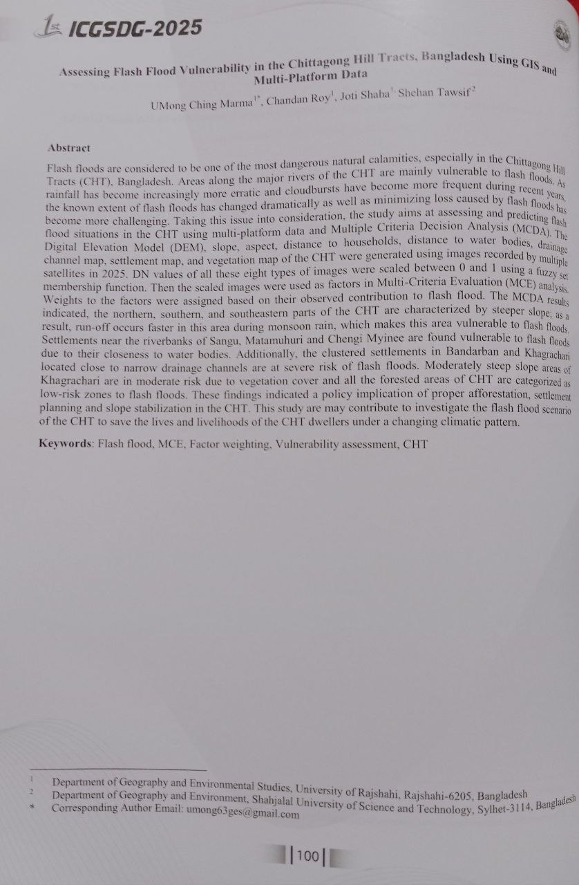
Assessing Flash Flood Vulnerability in the Chittagong Hill Tracts, Bangladesh using GIS and Multi-Platform Data
Joti Shaha, Chandan Roy, Shehan Tawsif & UMong Ching Marma
International Conference on Geosciences for Achieving Sustainable Development Goals (ICGSDG), 14–15 November 2025
RURS · 22–23 February 2024 · Credential ID: 24035
Identification of Vegetation Dynamics in Bangladesh Under a Changing Climatic Scenario
Joti Shaha, Chandan Roy & Arpita Adhikary
Rajshahi University Research Society (RURS) · 22–23 February 2024 · Credential ID: 24035
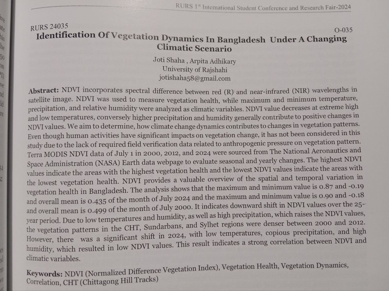
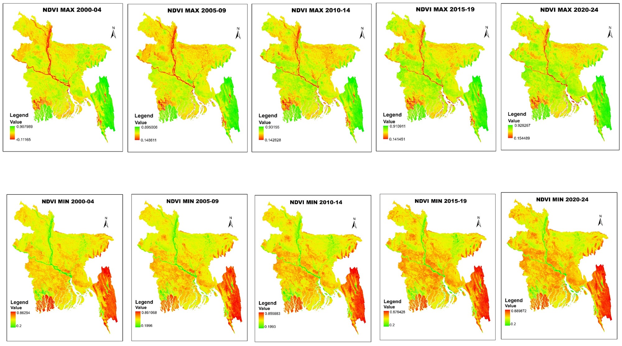
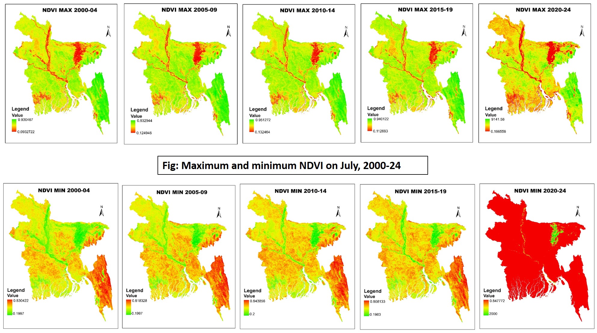
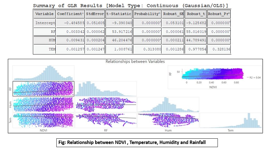
NDVI incorporates spectral difference between red (R) and near-infrared (NIR) wavelengths in satellite image. NDVI was used to measure vegetation health, while maximum and minimum temperature, precipitation, and relative humidity were analyzed as climatic variables. NDVI value decreases at extreme high and low temperatures, conversely higher precipitation and humidity generally contribute to positive changes in NDVI values. We aim to determine, how climate change dynamics contributes to changes in vegetation patterns. Even though human activities have significant impacts on vegetation change, it has not been considered in this study due to the lack of required field verification data related to anthropogenic pressure on vegetation pattern. Terra MODIS NDVI data of July 1 in 2000, 2012, and 2024 were sourced from The National Aeronautics and Space Administration (NASA) Earth data webpage to evaluate seasonal and yearly changes. The highest NDVI values indicate the areas with the highest vegetation health and the lowest NDVI values indicate the areas with the lowest vegetation health. NDVI provides a valuable overview of the spatial and temporal variation in vegetation health in Bangladesh. The analysis shows that the maximum and minimum value is 0.87 and -0.19 and overall mean is 0.435 of the month of July 2024 and the maximum and minimum value is 0.90 and -0.18 and overall mean is 0.499 of the month of July 2000. It indicates downward shift in NDVI values over the 25-year period. Due to low temperatures and humidity, as well as high precipitation, which raises the NDVI values, the vegetation patterns in the CHT, Sundarbans, and Sylhet regions were denser between 2000 and 2012. However, there was a significant shift in 2024, with low temperatures, copious precipitation, and high humidity, which resulted in low NDVI values. This result indicates a strong correlation between NDVI and climatic variables.
ssss
RURS · 22–23 February 2024 · Credential ID: 24085
Identification of Sea Surface Temperature Variability in the Bay of Bengal during the period of 1990 to 2024
Joti Shaha, Chandan Roy & Arpita Adhikary
Rajshahi University Research Society (RURS) · 22–23 February 2024 · Credential ID: 24085
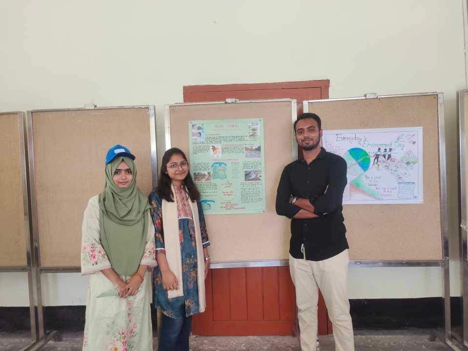
World Environment Day · 05 June 2024 · University of Rajshahi
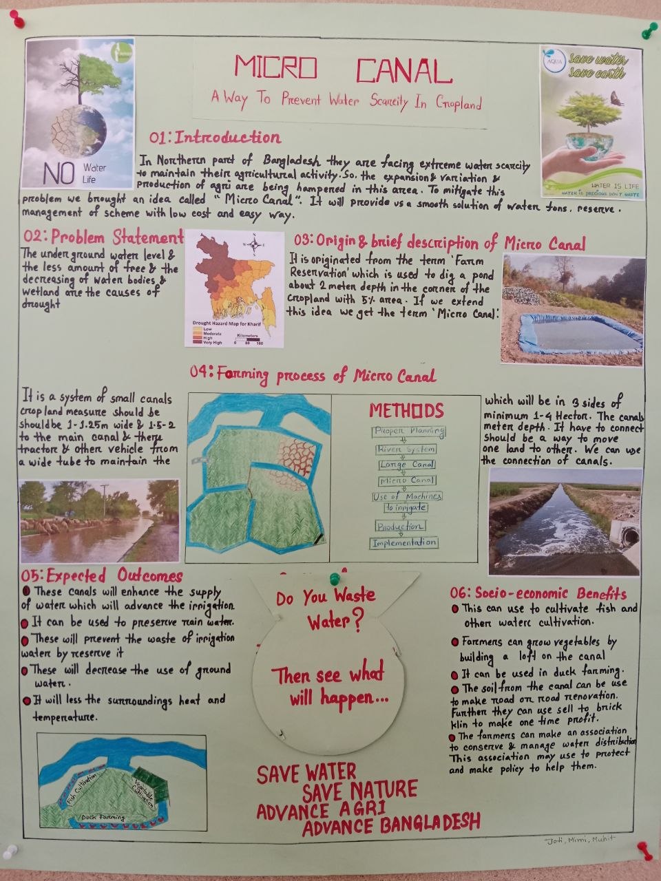
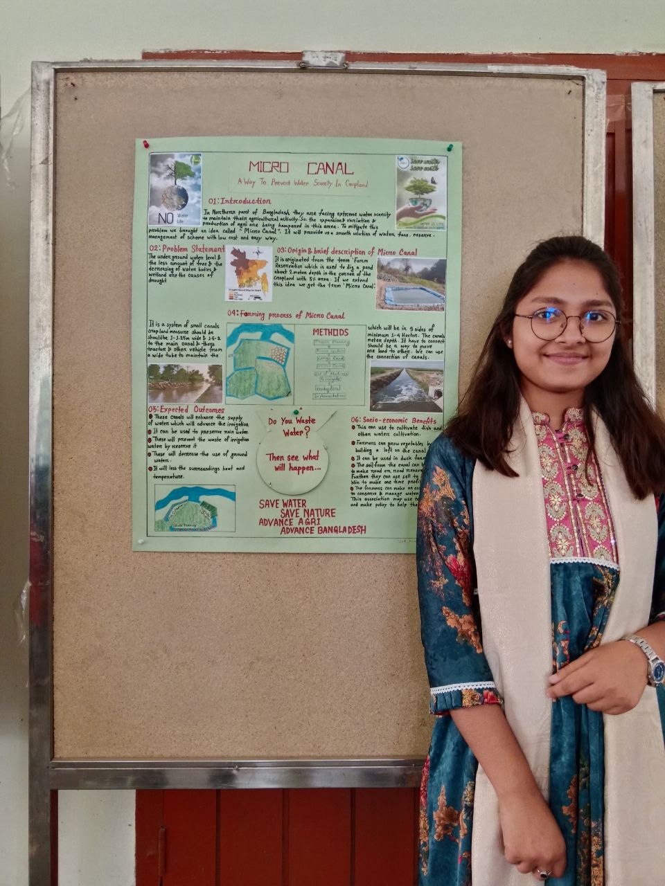
MICRO CANAL: A Way To Prevent Water Scarcity In Cropland
World Environment Day Poster Presentation, 05 June 2024, University of Rajshahi
Explored micro-canal design as a sustainable low-cost irrigation solution to address seasonal water scarcity in agricultural land, with spatial analysis of optimal routing using GIS.
Hydrology and Fluvial Morphology · 04 August 2024 · University of Rajshahi
Identification of Drainage Pattern of Bangladesh
Hydrology and Fluvial Morphology based poster presentation, 04 August 2024, University of Rajshahi
Bangladesh has one of the most complex and active water systems in the world, mainly driven by the Ganges-Brahmaputra-Meghna (GBM) river systems. The country's landscape creates a mostly branching and winding drainage system across its wide deltaic plains, while the eastern hilly areas show trellis and rectangular patterns. These river systems carry a lot of sediment and experience changes in water flow throughout the seasons, which causes regular shifting and intertwining of channels. This study uses Geospatial Analysis and Digital Elevation Models (DEM) to outline watershed boundaries and measure shape characteristics. This helps us understand the water behavior, flood risk, and environmental changes in the Bengal Basin.
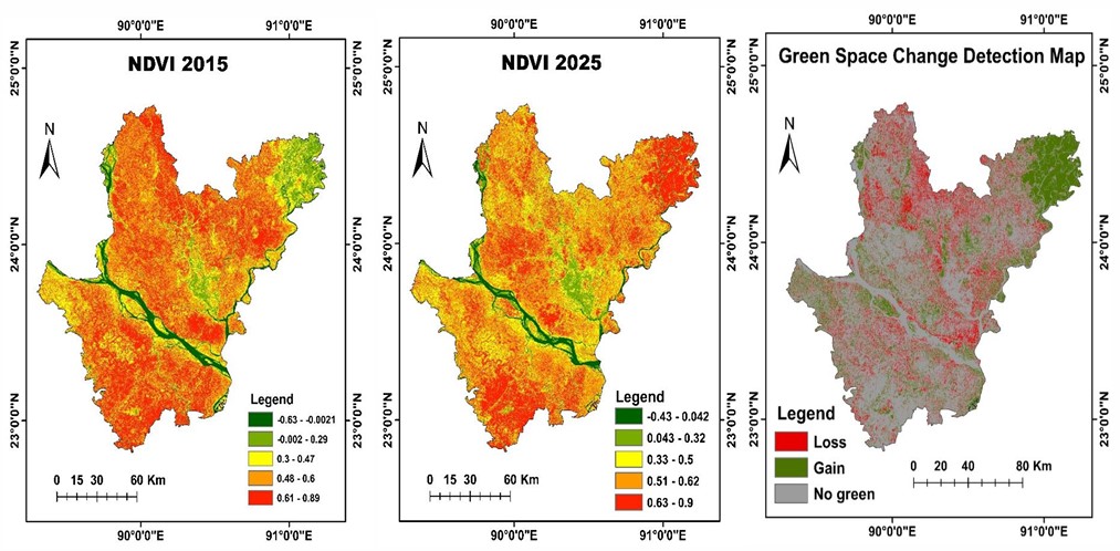
Urban Green Space Dynamics in Dhaka City (2015–2025)
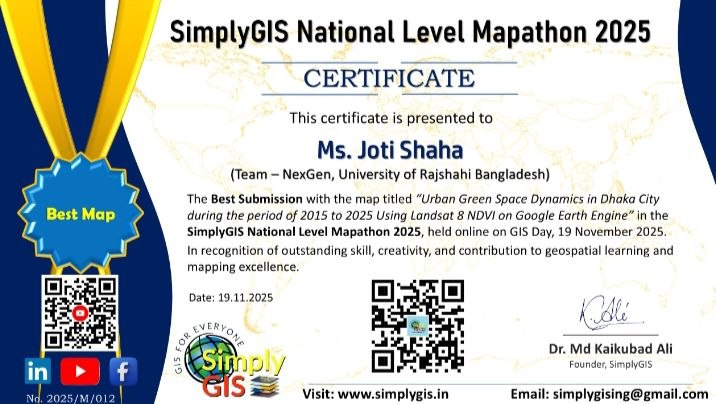
Urban Green Space Dynamics in Dhaka City during the period of 2015 to 2025 using Landsat 8 NDVI on Google Earth Engine
SimplyGIS National Level Mapathon 2025
Landsat 8 satellite imagery processed on GEE to compute NDVI values for Dhaka City across multiple years. Change detection analysis applied to quantify the spatial distribution and temporal change of urban green spaces.
Forewarn Bangladesh Start Network · 2024
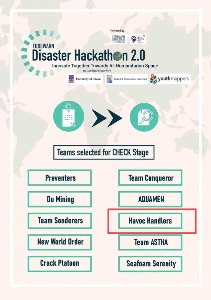
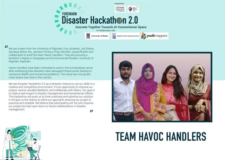
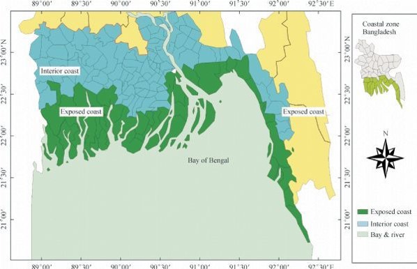
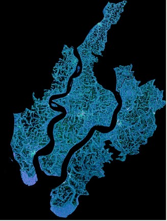
AUTOMATED INFRASTRUCTURAL DAMAGE ASSESSMENT: Developing Real Time Maps of Infrastructure Damage
Disaster Hackathon 2.0, Forewarn Bangladesh Start Network, 2024
Developed a system for automated detection and mapping of infrastructure damage using real-time satellite imagery and GIS tools, designed to support rapid disaster response in Bangladesh.
OpenStreetMap Bangladesh · May 22, 2024
OSMBD Mapathon with OpenStreetMap, OpenStreetMap Bangladesh, May 22, 2024
Participated in a national-level mapathon contributing geospatial data to OpenStreetMap Bangladesh, supporting humanitarian and open mapping goals across the country.
Professional certifications from Esri, Google Earth Engine, and Humanitarian OpenStreetMap
Research Tech Hub
Esri — MOOC (6 weeks)
Esri
Esri — MOOC (6 weeks)
Esri — MOOC (4 weeks)
Esri
Asia Pacific and Humanitarian OpenStreetMap Team (HOT)
Specialized training programs in GEE, QGIS, flood mapping, and OSM (2024–2025)
ProSkill Academia
Spatial Thoughts
YouthMappers and TomTom
GEO University
YouthMappers at RU
Member · May 2022 – Present
Member — YouthMappers at RU, Rajshahi University Chapter
May 2022 – Present
Volunteered for geospatial data input, organized community mapping events, and built partnerships with other YouthMappers chapters and OpenStreetMap communities.
Bangladesh · July 2024 – December 2024
Volunteer and Speaker — State of the Map Asia, Bangladesh
July 2024 – December 2024
Participated in social welfare activities and geospatial community engagement at the State of the Map Asia conference in Bangladesh.
Open Mapping Hub Asia Pacific · October 2024 – Present
Open Mapping Guru — Open Mapping Hub Asia Pacific
October 2024 – Present
Recognized as an Open Mapping Guru by the Asia Pacific Humanitarian OpenStreetMap Team, contributing to regional open mapping capacity building and community leadership.
Space and Environment Research Center · June 2024 – February 2025
Program Executive — Space and Environment Research Center (SERC), Bangladesh
June 2024 – February 2025
Wetland Conservation Bangladesh — contributed to geospatial analysis, mapping, and environmental monitoring for wetland conservation initiatives across Bangladesh.